In our last blog we discussed three broad categories of agricultural intelligence solutions available today. The third category included the use of satellite imagery, which by all accounts, has the ability to forever change our view, expectations and usage of agricultural intelligence.
The promise of satellite imagery is tied to the fact that every point on earth can be captured in a satellite image up to four times a day. While the resolution of the satellites that make such frequent passes may not provide high resolution pictures for Google Earth, they do contain highly useful information on crops. Compare this to the current way data is obtained for information such as crop acreage, yield projections, production estimates and crop conditions. Today these are still very manual processes and an inexact science.

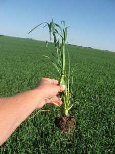
While important, manual crop sampling can not possibly provide 100% coverage of crops like satellite imagery can.
Data collected by the USDA, large agriculture corporations and farm owners alike are still based on phone surveys, crop tours surveying a few square feet area to extrapolate yield for thousands of acres. When used in conjunction with large historical databases this provides serviceable information but nothing compared to what is achievable today or the future promise of what will be achievable through the use of satellite imagery.
Today a few companies, such as GDA, provide agricultural intelligence based on satellite imagery. While we have made tremendous progress over the past decade in optimizing our technology and developing operational delivery of agricultural intelligence, we are just scratching the surface of what is possible. With the introduction of higher resolution satellites, advances in cloud computing and continued development of our own technologies, the full promise of remote sensing and satellite imagery is right around the corner. It’s going to be a fun ride!
Do you foresee using satellite image based agricultural intelligence? Why or why not?
Share your experience and expertise through the comments section and follow us on Twitter, LinkedIn, Facebook or through the available RSS feed.

 Follow
Complex Post. This transmit helped me in my university assignment. Thanks Alot
J’aime vraiment votre article. J’ai essaye de trouver de nombreux en ligne et trouver le v?tre pour être la meilleure de toutes.
Mon francais n’est pas tres bon, je suis de l’Allemagne.
Mon blog:
meilleur taux aussi Rachat de credit voiture
Greetings from Florida! I’m bored to tears at work so I decided to check out your blog on my iphone during lunch break. I love the info you provide here and can’t wait to take a look when I get home. I’m surprised at how fast your blog loaded on my cell phone .. I’m not even using WIFI, just 3G .. Anyways, fantastic blog!
Great Post! Thanks for giving detailed description about blog.
Cool! That’s a clveer way of looking at it!